Once upon a time Østfold was a just a collection of skerries.
Around 11 000 year ago Østfold rose from the ice age.
In the woods near Høgnipen, a hill between Rakkestad and Sarpsborg and just east of the wonderful WOC terrain Knatterudfjellet, archaeologists have found remnants of settlements that are about 10 000 years old. The first humans who came here during the Stone Age occupied what was then skerries and islets in the ocean. These people were hunters and fishermen.
What was the terrain like back then? The birch forest had started spreading in Østfold and pine and hazel were seeding in the landscape. The wooden landscape was open with grass and herbs; perhaps well suited for cross-country orienteering?
As years went by the water retracted and the topography of Østfold became like we know it today. Now the remnants of these ancient camps are located 150-160 metres above the current sea level.
Mountainous Østfold
Still close to the ocean and with a landscape not exactly stretching far into the mountains, Østfold may well be labelled the flattest county in Norway. Orienteerers from Sweden and Finland will find the terrain familiar and the hills are rarely overly tough.
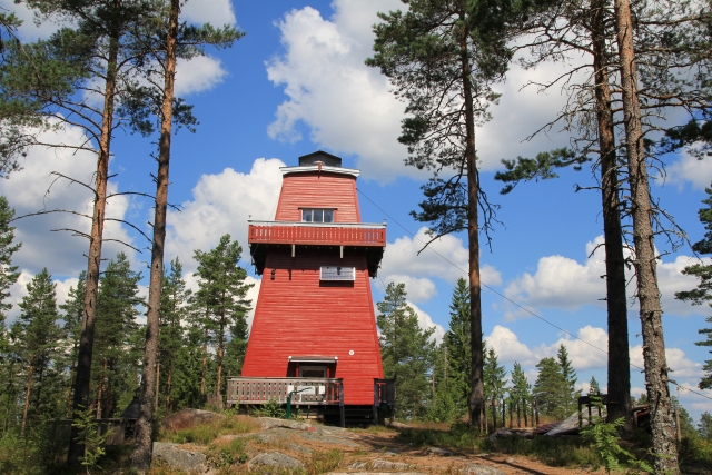
The highest “mountain” is rising just 336 metres above the sea. The peak is called Slavasshøgda and is just a mound in the forest in the Rømskog municipality. The view is rather unimpressive. In terms of views, the county’s second-highest peak is considerably more attractive. Just 1.4 metres lower than Slavasshøgda, the peak of Haukenesfjellet is also located in Rømskog. There you can climb an old fire tower, recently restored by the Norwegian Trekking Association. It is even possible to sleep in the tower.
Rømskog is Østfold’s alpine region – as long as it lasts. In 2020 Rømskog will become part of the municipality of Aurskog-Høland and transfer from Østfold to the neighbouring Akershus county. Consequently, Østfold will become even flatter! Mountain-loving Østfold people may take comfort in the fact that Østfold, Akershus and Buskerud are due to merge at the same time and form a new region named Viken. Viken will claim the peak of Folarskardnuten (1933 m.a.s.l), located in Hol in Buskerud, as its highest mountain. However, that top is very far from WOC 2019.
Great view – small area
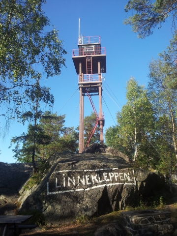
If you really wish to enjoy a good panorama of Østfold, it is probably best to climb Linnekleppen (325 m.a.s.l) in the “Fjella” area between Rakkestad and Marker. On the peak stands Europe’s only staffed fire tower. The view is breath-taking in every direction.

From the fire tower at Linnekleppen you can see most of Østfold. Credit: Hebue/Wikimedia Commons.
Bear in mind, Østfold is not large; just 80 kilometres wide and 100 kilometres long. However, with 293 000 people it is the sixth most populous county in Norway. That is perhaps hard to believe when standing on the top of Linnekleppen surrounded by woods as far as the eye can see. But many people live around the mouth of the Glomma river in the cities of Sarpsborg and Fredrikstad. Glomma, by the way, is the longest river in Norway, but only the “finish” of it flows through Østfold before the mass of water hits the ocean.


